
major function
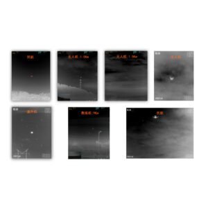
Target search function: equipped with long-distance, large-scale, target search and detection functions;
Target detection function: equipped with intelligent analysis and determination of target detection, aviation construction, and threat level;
Target tracking and ranging function: equipped with high-precision target tracking and target distance measurement
Distance measurement function:
Target guidance function: equipped with target guidance data output function, which can guide other systems to track and dispose of targets;
Comprehensive display and control function:
a) Display, store, and replay images of the detection area;
b) Display and indicate the location of threat targets such as personnel, armored vehicles, tanks, drones, helicopters, etc,
c) Collect and display system status;
d) Control the system to achieve various human-computer interaction functions,
Having communication and networking interfaces to achieve information interconnection and intercommunication.
Detection distance (visibility not less than 25km)
The detection range of the drone is not less than 2.5 kilometers
The personnel detection distance shall not be less than 9 kilometers;
Armored vehicles (3mx6m) with a detection range of not less than 20 kilometers:
Helicopter detection range not less than 22 kilometers
Infrared thermal imager
Refrigerated MCT focal plane detector:
Resolution (number of pixels): 640×512:
Working band: 3.7um~4.8um;
Focal length: 15mm~300mm;
F-number: 4.0.
Cooling time: ≤ 8 minutes (full temperature):
Noise equivalent temperature difference (NETD): better than 35mk (@ F4, 25 ° C):
Minimum Discriminable Temperature Difference (MRTD): ≤ 0.3K.
laser ranging
Laser wavelength: 1.57um;
Measurement range: not less than 20km (visibility not less than 20km):
Minimum measuring range: not exceeding 100m;
Distance measurement accuracy: ± 5m
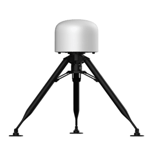
Power Supply and Power
Rated voltage: 48V DC:
Rated power: not exceeding 150W
Environmental adaptability
Working temperature:- 40~+55 ℃ C:. Storage temperature:- 50~+70℃℃;
Vibration, impact, humidity, rain, and electromagnetic compatibility meet the relevant requirements of GJB vehicle mounted equipment.
Identification distance (visibility not less than 20km)
Drone recognition distance not less than 1 kilometer:
The personnel identification distance shall not be less than 3 kilometers
Armored vehicles (3mx6m) with a recognition distance of not less than 7 kilometers:
Helicopter recognition distance not less than 8 kilometers
White light camera
Sensor: High Dynamic CMOS Sensor
Focal length: 10~550mm;
Field of view angle: 58.5 °~1.17 ° (horizontal), 35 °~0.66 ° (vertical): Resolution: highest 2688×1520@30FPS
Minimum illumination: 0.0005Lux
Shutter: 1~1/30000 seconds
Image settings: brightness, contrast, saturation, sharpness, gamma. Image functions: optical fog transmission, electronic image stabilization, auto focus, auto gain, wide dynamic range, backlight compensation, strong light suppression, white balance.
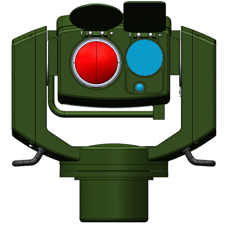
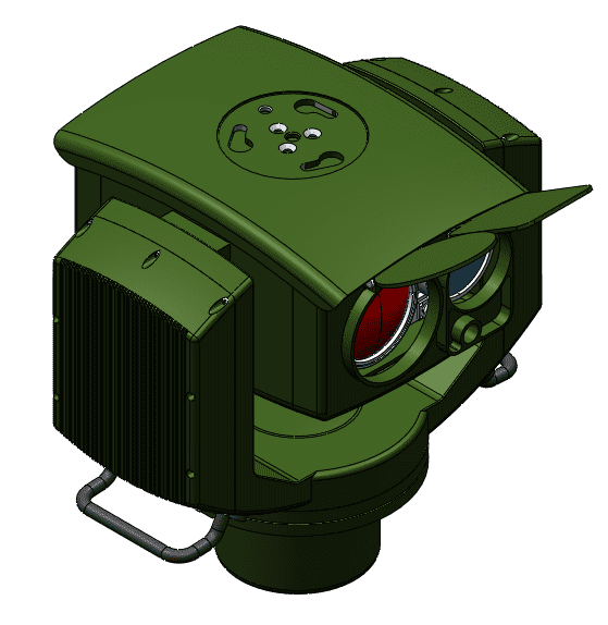
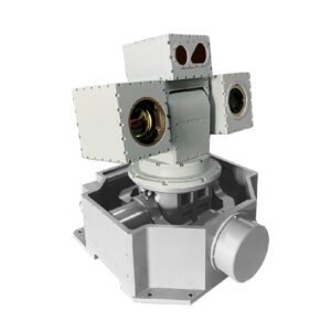
Photoelectric warning turret
Range of azimuth: 360 ° continuous;
Pitch range:- 30~+75°:
Range of azimuth and elevation velocity: 0~180 °/s;
Search speed: up to 90 °/s.
Position pointing accuracy: 0.3mrad;
Gyroscope stability accuracy: 1mrad (15):
Pre set cruise: supports weekly scan, fan scan, area scan, and fixed-point scan search cruise modes:
Maximum tracking angular velocity: 10 °/s;
Tracking accuracy: not greater than 1mrad;
·Size: not greater than 550x440x350mm (length x width x height)
Weight: not exceeding 20kg.
了解 SHENZHEN LEISHI SENSING OPTOELECTRONICS CO., LTD. 的更多信息
订阅后即可通过电子邮件收到最新文章。
评价
目前还没有评价